With the Olympics on, I wanted to plan some dives in the opposite direction of the Sea to Sky highway. There were a few dives sites up the Indian Arm that I'd been wanting to check out so this was a great motivating factor to do just that.
Doing some research, my options were White Rock, Whiskey Cove and the wreck of the VT-100. I picked the wreck because I figured it would be more of an incentive for folks to come out. Also, if it fell through, Whiskey Cove was just a few minutes to the south and made a good backup dive site.
The VT-100 had some interesting facts. All the details are in this link:
Wreck detail link (map of wreck near last pages)
In summary though, it had some interesting history. Formerly the YMS-159 which saw service as a minesweeper in WWII, it was sold as surplus and was renamed Vancouver Tug 100. Then vandals set fire to it and it sank. For a long time people called it the HMCS Cranbrook, but that was a mistake and was corrected not too long ago. The article above has a lot more details on the story. I found it pretty interesting.
At Porteau Cove, another YMS class minesweeper was sunk called the Nakaya. People say that the Nakaya is arguably a more interesting wreck. It's a longer swim to the Nakaya though, but I am planning to see that one too soon.
Some details that are nice to know for diving the VT-100 follow.
Bathroom facilities only exist at Belcara Park, so go before you leave! All along the road are private boat docks and launches and houses so be careful and respectful. There is limited parking on the shoulder of the road. There are no “official” parking spots. Just get the car as far off the road as you can. This is a Google street view of the parking area. The dive site is right beside it. Right by the small no parking sign is the trail that goes down to the water. There are no steps, but there is a rope to help you. The trail is pretty steep and slippery. It's hard to spot the trail but it's there. Here is a Google Map link of where you need to park. Basically you just go down the trail, get into the water, and head on a 330 degree compass heading until you run into the wreck. It lies about 300 metres off the eastern shore of Bedwell Bay and the depths are 55 feet at the bow, 42 feet at the stern.
When Jason and I arrived, we had a hard time finding the dive site. There was a white buoy out in the water that tricked us for a while. The wreck is not marked in any way, unlike the wrecks at Porteau Cove. The white marker is far far to the south of where the wreck really was.
We asked a resident where divers normally go, but they didn't have any useful details. Finally we found where we needed to be. Funny enough, another pair of divers arrived just then so we were doubly sure we were in the right place. There was room for 3 or 4 cars at the side of the road so that worked out. Mihai arrived not long after and so we were all there and ready.
It was an awesome day. The sun was out, and it was over 10 degrees. It felt like a summer dive. The water was still 8 degrees, but I didn't expect much different. There was a lot of dog “business” everywhere. I'm not sure if it was local residents purposefully not picking up after their pet to discourage divers, or if it was just lazy people. Regardless, it was pretty disgusting. I ended up getting dog poop on a lot of my gear and shoes. Yuck. There was a big bald eagle in the tree beside us though, so that was pretty nice at least.
The divers ahead of us seemed to be having some problems and we watched them surface soon after they went down. It didn't look like they were in the right area. They moved over a ways and I think they found the wreck then. Their bubbles gave a bit of a visual reference on where we probably should end up.
When we got into the water, I really understood what people meant when they said “muddy bottom”. The whole trip out to the wreck was one big mud flat. There really wasn't much to see in terms of life. There was one or two lone plumose anemones jutting up out of the mud. A toilet? Yes, there was a toilet lying on the bottom on the way. There were a few boulders, too. Overall, a featureless desert. Sure, there was lots of stuff living in the mud, as well as crabs running around, but it just wasn't that interesting to me. But, it did give an opportunity to practice careful propulsion. If you didn't, the resulting silt storm made seeing next to impossible.
It seemed like forever before we found the wreck, but it was only maybe 7 or so minutes into the dive. The VT-100 was pretty much just a pile of debris. It was vaguely ship-shaped, but the vast majority of it had rotted away. There were several bulkheads still standing which wobbled dangerously. The gun turret that I read about was still there but was not very impressive. We circled the wreck once, and then headed back. There were a lot of graceful decorator crabs and longhorn decorator crabs on the various bits of broken rotting wooden hull. Some schools of perch were swimming around too. However, compared to the Grant Hall at Porteau Cove, the VT-100 was pretty barren.
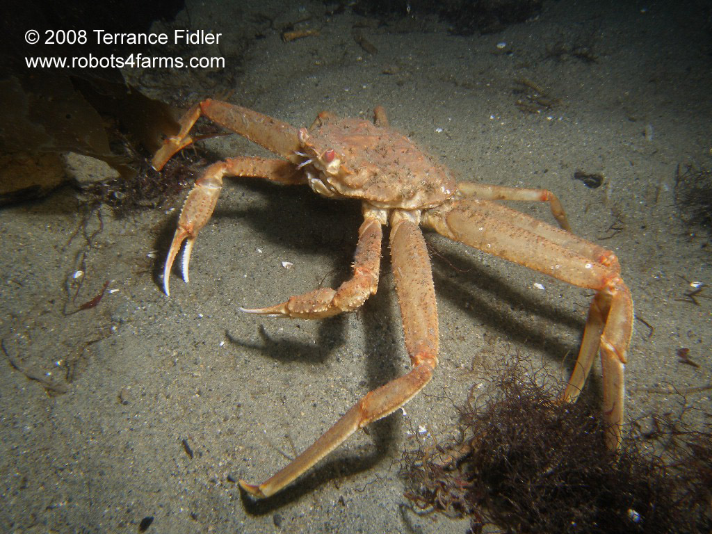
On the way back to shore, I did see some Northern hairy chitons and a a small tanner crab. We also came across two other “wrecks”. On the muddy bottom was a small white skiff, sunk and upside down. Beside it was a larger fibreglass speed boat. Not that interesting, but unexpected!
The final ascent up to shore was the best. The sun had come out, and was streaming down into the water. The visibility opened up a lot too. Being able to see the surface while swimming underwater was very cool.
On the second tour around the VT-100, we saw the marine life high-light, a golden dirona. It was spectacular.
In the end, I was glad to check out this wreck, but I don't think I'd go back any time soon without a good reason. There were certainly more interesting dive sites to visit.

No comments:
Post a Comment